I had a wedding to attend in the Catskill Mountains of New York a couple of week ago. On my way there, I decided to stop for a little hike up Hunter Mountain.
I didn’t realize at the time how intense this hike would really be. While incredibly strenuous, it was exactly what my body craved after months on end living at near sea level in Florida.
In this post, I describe the entire hike from start to finish, including some info and tips to having a great experience!
Hunter Mountain
Originally named Greenland Mountain, Hunter Mountain is a part of the Catskill Mountains of in Green County, New York. Hunter is part of the Hudson River watershed which feeds into New York City’s watershed.
The mountain is most famous for its ski resort to the Northwest. The summit is located further away, however, adorned with a steel fire tower built in 1953.
As the second highest mountain in New York State, Hunter is included on the Northeast 111 (or 115) peakbagging list for being a minimum 4,000 foot mountain.
There are 4 routes up Hunter Mountain: Spruceton Trail, Devil's Path and Hunter Mountain Trail, Colonel's Chair Trail (from the ski resort), and Becker Hollow Trail.
Finding Becker Hollow Trail
The location of Becker Hollow Trail at 42°10'54.4"N, 74°11'48.9"W or the address is 4120 NY-214, Elka Park, NY 12427.
I drove from the East toward Hunter, New York along route 23A. I turned left onto route 214. The trailhead is past Ski Bowl road and before Lane Road on the right.
Fun fact, Becker Hollow Trail is near the spa where Monica Lewinsky first ever disclosed to a friend her affair with Bill Clinton. It was on Memorial Day weekend in 1996 when she told Dale Young at Vatra, a spa near the Becker Hollow trailhead.
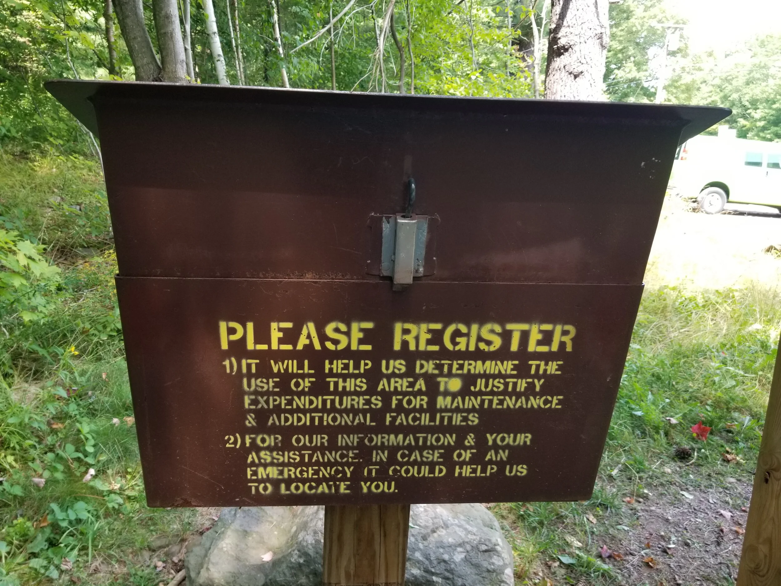
Trailhead Registration
At the start of any marked trail there is usually maps and a registration box. I recommend always registering before starting a hike.
You never know what trouble you might run into between faulty footing or wild animals. Checking in to register may be the difference between being helped or not.
Additionally, this supports the local parks in getting a count of visitors each year for future funding to maintain the trails.
Registration usually asks some basic contact information, number in your hiking party, length of stay, hiking plan, and check-out mark. I’ve never forgotten to check out at one of these. But I always wonder if I forget to check out if I’d get a call from a park ranger. I would imagine they would follow up especially if I did not check out after my planned length of stay.
Becker Hollow Trail Hike
Becker Hollow Trail is the least popular route up Hunter Mountain. After climbing it…I may know why!
While it’s the shortest trail it’s also the steepest trail to the top. I went up about 2,240 feet in 2.3 miles to reach its elevation of 4,040 feet. Becker Hollow Trail is intense!
The trail follows Blue Markers all the way to the top starting at two stone pillars. These pillars used to be an archway.
The first half mile or so is mostly flat ground on a slight incline. The path follows through a forest that used to be a farm owned by the Becker family.
With a stream to the right, the trail soon led over a wooden foot bridge. With stream at my left, I continued along the trail, through patches of wild flowers and over a trickling tributary.
Eventually, the path turned right and upwards away from the stream.
This is where the fun didn’t stop.
The trail continued at a steep incline for the next 1.7 or so miles. Straight up, the path got only steeper as I went. At first, the path was mainly dirt with some rocks. One part of the path had an exposed root system that acted as natural stairs for a brief part.
Ultimately, the ascent was a continuous, unforgiving uphill climb with increasingly looser rocks beneath my feet.
The trail is mostly forest views all the way up. There are no mountain views because the path is so shaded. This does afford lots of fungi to grow. I enjoyed spotting and photographing them along the way.
The temperature reached 94 degrees Fahrenheit the day I hiked. Luckily, I am pretty adaptable in the heat and the path was mostly shaded. Even still, I am certain I would have quit this hike half-way up if it was sun-exposed because the humidity alone was rough! I was a sweaty monster after only a few minutes in.
The Yellow Loop Trail
I knew I was reaching the summit when the trees started getting shorter and I could see more sky above. Soon, I reached the first set of signs pointing two ways to the Tower. One pointed right along a yellow trail toward “Hunter Mt. Tower” and the other kept leading me up following blue markers.
The yellow trail looked flat and easier. I wanted to keep challenging myself. So I decided to keep going up.
While I didn’t take the yellow loop trail, many who hike Becker Hollow recommend taking it since it connects back anyway.
Apparently, there are some switchbacks that assist with the rest of the upward climb until you reach the Tower clearing.
Blue To The Fire Tower
I decided to skip the loop and continue to push upward toward the summit. An additional .3 miles straight up brought me to a square platform—the remnants of the old pre-1953 Fire Tower.
Another set of signs pointed me right along the flat top of the mountain toward the current Fire Tower. This path was a bit muddy in parts.
The forest along the sides of the path were wonderfully filled with a later of moss. This reminded me a lot of the mossy forests of southern New Zealand.
Fire Tower Views
A pathway between pine trees opened up to a large clearing at the tower.
Strolling up, I found two hikers setting up a radio antennae attached to the tower. They told me “don’t mind us”—they were just calling a station to test their radio system (it worked).
Only two other people showed up at the tower while I was there. In fact, these two sets of hikers were the only other hikers I saw all day except a man and his husky pup at the very end of the day at the start of the trail. By the it was after 5pm so maybe he was just a local walking his dog for a bit.
There was nobody else on the Becker Hollow Trail—probably because it was a Friday. I did see 3-4 cars parked at the trailhead on Sunday on my way out of the region. Otherwise, I think rumors are right that this is a fairly unpopular trail.
I climbed the tower to find the top-most part was locked.
So I stood at a lower level to take in the 360-degree views.
From the tower, I could see many other mountains in the area: To the southeast there’s Indian Head, Twin, Sugarloaf, and Plateau Mountain. I could see the Blackhead to the northeast. Of course, the Hunter mountain ski resort was due north.
Click for larger panoramic image
So different from the craggy, snowy peaks of Colorado, New York’s mountains are mostly rolling and green in summer—beautiful in their own uniqueness.
I sat down for lunch on the stairs nearest the top of the tower. There was a slight breeze which was perfect to cool down my warm body against my wet cloths. I cooled down fairly quick as I munched on my store-bought sandwich and blueberries.
I took my first gulps of water here, too. Yes, I am weird in that I do not reward myself with water until I reach the peak on a short hike like this. I drank an entire liter in 20 minutes! I had another liter ready for when I reached the bottom.
Never Underestimate Downhill
What comes up, must come down, as they say! Most people think the way down will be easier on a hike, but that is a rookie mistake.
Coming up, I knew immediately that I needed to mentally prepare for the way back down. Mentally and physically. Toward the start of the hike, I searched the edges of the trail for a good walking stick. I knew I would need it, especially on the hike back down. I found one about 20 minutes into the hike and it proved to be a knee-saver!
Knees are one of the most impacted parts of the body on a hike. You use them a lot on the way up, bending and lifting your body weight, weakening them with each step. Then you depend on them to help you break all the way back down. A hiking stick can help alleviate some of the weight.
I feared my knees were about to hate me! I was surprised they didn’t really start to hurt until half way down. When I reached the bottom, I could feel that they were reaching their limit. I was glad to be at the end and grateful for my walking stick which helped bear some of the weight of the ascent and balance me on the descent.
A Tracked Workout
Becker Hollow Trail takes on average about 4.5 hours to hike from start to finish. I took about 3.5 hours plus a 20 minute lunch at the top. I ascended at a fairly constant pace, only occasionally pausing for a photo or to catch my breath for a few extra seconds.
This is just how I hike. I tend to push through—and push and push—no matter how fast my heart beats or how sweaty I get.
This was a serious workout especially after many months of living in Florida on flat ground (without any natural hills even!). Since it was so intense, I thought it would be fun to share the hike as tracked by my Fitbit.
I still have an old Charge 2 and it works great for giving me a general output of steps and heart rate.
The dip in the middle is a 20 minute lunch break I took at the tower. I also finished where the line is at 3:47—I forgot to shut off the workout tracker for the 30 minutes after diving away and meeting my friends.
In Conclusion
I am so glad I went on this hike up Hunter Mountain before attending the wedding.
This was exactly the nature experience I needed. Living in Southern Florida fulfills all of my sea-side adventure needs. But with barely a hill to climb there, I was eager to get up a mountain while in the Catskills of New York State.
I ended up climbing the second tallest mountain in the state in a short timeframe. All in all, Hunter Mountain was equal parts challenging and awesome with a great payoff in views at the top!


